
Ski Touring

Omar Oprandi



10 peaks solo, over 76 miles of svulippo and 4000 meters in altitude routes in 7 hours 40 minutes
Friday 18 April 2014 6 minutes reading time
If you think that the "cite" Ski mountaineering is only the quiet walks to reach the shelters, you never knew Omar Oprandi.
He is a great lover of the mountain in all its forms, is mountain guide, a true athlete, and as he calls himself Coach Ski Mountain and Ski Mountain Explorer, but more importantly, Omar '' a friend who often likes to share with us the tales of his exploits.
 What we tell you today is l'' crossed the Chain Monte Baldo from Torbole to Peschiera.
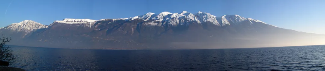
The crossing of the Chain Monte Baldo a wonderful journey that develops largely on the thin line that divides the valley of the Adige'' from Lake Garda. The point of departure and arrival, and perhaps a little unusual'' for skialp, are nothing but the river is a tributary of Lake Garda and the Sarca at Torbole province of Trento, and his emissary, the river Mincio at Peschiera. It is a very long'' crossed that winds along the sinuous and wild ridge from Monte Altissimo (2079 m) to Monte Sparavero (1512 m) last major summit of Monte Baldo. The view is always exceptional and fascinating: an expanse of endless mountains from North to South, East to Lake Garda, 41 km long, and on the east side of the equally long Vallagarina, a large, deep valley that serves as the Ice Age to the river bed South Tyrol.
The itinerary
The start is on the bridge of the highway that connects Torbole Riva del Garda, over the river Sarca (mouth of Lake Garda) shortly before the ascent to the loc. Busatte. Continue along the "Strada del Monte Baldo" up to Prati di Nago through the Mga Zures and Dos Casina. Meadows Nago fit skis and continue to the first elevation of the Baldo: Mount Varagna at an altitude of 1779 m. From here, with slight ups and downs we reach the wonderful Top of Mt High 2079 m where the first real climb of more than 2000 m of dislivello.Poco over the ridge is named after the village of Navene, more than 1400 m down, right on the lake. '' And from this point onwards that the ridge tapers through numerous peaks with a continuous alternation of ascents and descents, as well as passages highly mountaineering, certainly not trivial.
The peaks which alternate with the forks are a real "break legs" that forces one to many "change of attitude" pointing directly toward the south, then towards the end of Lake Garda. A journey where we can not relax because Top each can become an obstacle which, on the side opposite to the direction of travel, can hide big unknowns.
Only at the end of this interminable ridge and the elimination of more than fifteen peaks, we arrive in the territory of San Zeno di Montagna in the locality Candles to 695 m. Achieving these countries and immediately resume contact with the "noisy modern civilization" is suffer trauma as a small but becomes even more appreciate the "journey" addressed.
From this village is missing "only" the final part of the route, but much more easy since you only have to go down to Affi and then on the shores of Lake Garda in Lazise. From this point, along the lake, you come to an end in the town of Peschiera, just on a bridge similar to the start, above the outlet of the lake, the river Mincio.
© ALL RIGHTS RESERVED
Social media engagement
Più letti in Regioni
Pila, dal 13 giugno riaprono gli impianti. La prima estate della Stella
Nuovi sentieri per il trekking, nuovi percorsi al bike park, apertura estiva della telecabina Pila–Stella, attività, visite guidate, eventi. A Pila è tutto pronto per iniziare l'estate 2026.
2