Snow Weather Forecast
Weather conditions and forecasts for the coming days


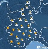
Piedmont - Weather situation in Piedmont
WIDESPREAD RAIN ON THURSDAY, CLEARING AND MILD TEMPERATURES ON FRIDAY, THEN COLDER AIR FROM THE EAST
A weather system linked to a new Atlantic storm, named Charles, will reach the Northwest starting during the night between Wednesday and Thursday, bringing widespread rain to Piedmont and Valle d'Aosta and snowfall still confined to high mountain areas.
The disturbance will be followed by northerly currents which on Friday will favor temporary clearing and foehn conditions south of the Alps, with strengthening foehn winds in the mountains and a temporary increase in temperatures, up to values above 15 ?C at low elevations.
The milder phase will nevertheless be short-lived. With the strengthening of high pressure north of the Alps, colder and more humid air will flow in from the east into the lower layers of the Po Valley from Saturday, causing a new increase in cloud cover, a drop in temperatures and some precipitation over the western sectors of Piedmont.
On Sunday, an extensive cloudy front between southern France and Sardinia could marginally affect the Northwest, bringing some rain and light snowfall down to low mountain elevations.
PROBABLE EVOLUTION THROUGH 20 NOVEMBER
Monday 16 November: extensive cloud cover will persist, with scattered rain, more sporadic over the plains, and snowfall in the Alpine valleys, initially down to medium-low elevations, but with the snow level progressively rising.
In the following days, milder westerly Atlantic currents will establish themselves again, with clearing alternating with partial cloud cover south of the Alps, while the inner Alpine areas will be affected by frequent precipitation, with snowfall mainly at high mountain elevations.
Maximum temperatures still below 10 ?C in the plains on Monday, subsequently rising to generally mild values, around 12/14 ?C at low elevations and above 5 ?C at 1500 m.
Weather forecasts for ski resorts in Piedmont:
- Alagna Valsesia
- Alpe Devero
- Alpe di Mera
- Argentera
- Artesina
- Bardonecchia
- Bielmonte
- Cesana
- Cima Durand
- Claviere
- Crissolo
- Domobianca
- Formazza
- Frabosa Soprana
- Garessio
- Limone Piemonte
- Lurisia
- Macugnaga
- Monte Moro
- Mottarone
- Oropa
- Pancani
- Pian Muné
- Pontechianale
- Pragelato
- Prali
- Prato Nevoso
- Sampeyre
- San Domenico di Varzo
- San Giacomo di Roburent
- Sansicario
- Sauze d'Oulx
- Sestriere
- Usseglio
- Valle Vigezzo
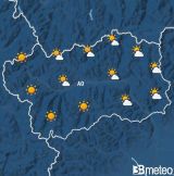
Aosta Valley - Weather situation in Aosta Valley
Initially clear or slightly cloudy. Clouds gradually increasing during the morning due to the development of cumulus clouds and passages of medium-high clouds, becoming partly or irregularly cloudy from the central hours in the valleys and cloudy or locally very cloudy in the mountains, particularly near the borders. From the central hours, showers or thunderstorms, locally moderate, will pass through, initially over the W-N peaks and then possibly extending to much of the region, more likely between the beginning and the middle of the afternoon.
Winds at 3000 metres will be light to moderate from NW in the morning, gradually strengthening from the afternoon to locally strong, while in the valleys they will be light and variable until mid-morning, then from W-NW, locally moderate in the western and central valleys; in the eastern valleys, from E-SE, generally light until mid-afternoon, then from W-NW, strengthening to moderate.
Compared with yesterday, maximum temperatures will be slightly lower in the valleys and lower in the mountains, with the freezing level, currently around 4000 metres, rising to approximately 4400 metres towards mid-afternoon.
At 1500 metres, temperatures will rise from 13?C to 21?C; at 3000 metres, they will range from 6?C to 8?C.
Weather forecasts for ski resorts in Aosta Valley:
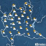
Lombardy - Weather situation in Lombardy
RAINY THURSDAY, MARKED IMPROVEMENT FROM TOMORROW Bad weather will continue to affect the region today, Thursday 12, with widespread rain; from tomorrow, Friday 13, the descent of a trough from northern Europe will cause a change in the airflow, bringing colder and drier air, before quickly rotating from the west. The sky will be overcast today and rain will affect the area, with locally moderate to heavy conditions; temperatures in the plains will reach around 13 ?C. Tomorrow, however, there will be more room for sunshine and the rain will be lighter and concentrated mostly during the first part of the day. The reduced cloud cover will favor an increase in maximum temperatures, which may approach 18-19 ?C in the plains and hilly areas. Strengthening winds are expected today over the plains and tomorrow also over the northern mountains, with foehn-like conditions. Saturday 14 and Sunday 15 will generally be stable, but cold air will persist, leading to a drop in temperatures. From next week there will be strong variability, starting as early as Monday 16, due to the possible descent of several low-pressure areas that may cause continuous deteriorations in conditions. Issued Thursday 12 November.
Friday 13 November by 10:00.Weather forecasts for ski resorts in Lombardy:
- Alpe Giumello
- Alpe Teglio
- Aprica
- Bormio
- Bormio 2000
- Bormio 3000
- Borno
- Carona
- Carosello 3000
- Caspoggio
- Chiesa in Valmalenco
- Colere
- Foppolo
- Forcora
- Ghiacciaio Presena
- Lanzada
- Livigno
- Lizzola
- Madesimo
- Malga Polzone
- Monte Pora Base
- Monte Pora Cima
- Montecampione
- Mottolino
- Passo del Maniva
- Passo del Tonale
- Passo della Presolana
- Passo dello Stelvio
- Piani di Artavaggio
- Piani di Bobbio
- Ponte di legno
- San Colombano Valdidentro
- San Simone
- Santa Caterina Valfurva
- Schilpario
- Secondino
- Temù
- Trepalle
- Val di Lei
- Val Palot
- Valtorta
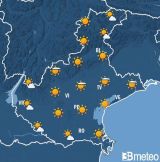
Veneto - Weather situation in Dolomites Veneto
Between Thursday and the first part of Friday, an Atlantic trough associated with a deep surface low-pressure system will move across Veneto, bringing a spell of unsettled weather; during the first phase, very mild air will be advected aloft from the south-west, while at the end of the event decidedly colder air masses will move in. Over the weekend, an intervening ridge will ensure stable atmospheric conditions in an almost wintry thermal context. On Monday, a new trough will move across the region, bringing further precipitation and a lower snowfall limit. Subsequently, a predominantly westerly flow will become established, with some cyclonic undulations that may bring some further precipitation amid generally variable conditions.
2026-11-12T16:00:00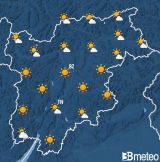
Trentino - Weather situation in Trentino
Today initially very cloudy with precipitation easing during the morning and northerly winds strengthening, with widespread clearing from the afternoon; temperatures still mild, with minimum temperatures expected in the evening. Saturday locally low clouds, otherwise very sunny with excellent visibility and cold temperatures, especially in the morning. Sunday increasing cloudiness in the second half of the day. Monday very cloudy with possible light precipitation. Tuesday some sunny spells in the morning, possible precipitation from the afternoon.
13/11/2026 - 06:45Weather forecasts for ski resorts in Trentino:
- Alba di Canazei
- Alpe Cermis
- Alpe Lusia Moena
- Andalo
- Bellamonte
- Campitello di Fassa
- Canazei
- Carisolo
- Cavalese
- Ciampedie
- Fai della Paganella
- Folgaria
- Folgarida
- Lavarone
- Madonna di Campiglio
- Marilleva
- Moena
- Molveno
- Monte Bondone
- Monte Spinale
- Panarotta
- Passo Fedaia
- Passo Groste
- Passo Pordoi
- Passo Rolle
- Passo San Pellegrino
- Pejo
- Pinzolo
- Pozza di Fassa
- San Martino di Castrozza
- Vigo di Fassa
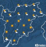
South Tyrol - Weather situation in South Tyrol
Saturday will be dominated by sunshine with generally clear skies, except for the presence of some patches of fog in the early morning. Temperature range: minimum values between -8° and 3°, maximum values between 2° and 11°. Forecast reliability: 90%.
Forecast for tomorrow, Saturday 14 November 2026Weather forecasts for ski resorts in South Tyrol:
- Alpe di Siusi
- Anterselva
- Belpiano
- Bressanone
- Carezza
- Catinaccio
- Corno Renon
- Corvara
- Dobbiaco
- Klausberg
- Ladurno
- Ladurns
- Maranza
- Maso Corto
- Merano 2000
- Monte Cavallo - Rosskopf
- Monte San Vigilio
- Obereggen
- Ortisei
- Pampeago
- Passo Costalunga
- Piani di Luzza
- Plaghera
- Plan de Corones
- Plan in Val Passiria
- Plose
- Polsa
- Predazzo
- Racines
- San Cassiano
- San Giacomo di Brentonico
- Santa Cristina Val Gardena
- Selva Val Gardena
- Sesto Pusteria
- Ski center Latemar
- Solda
- Speikboden
- Trafoi
- Val d'Ultimo
- Val Sarentino
- Val Senales
- Valles
- Vallon
- Villaggio Palumbo
- Vipiteno
- Watles
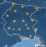
Friuli - Weather situation in Friuli (mountains)
The approach of an Atlantic depression is causing the influx of humid and mild southwesterly currents.
10-11-2026 11:48:37 UTCWeather forecasts for ski resorts in Friuli:
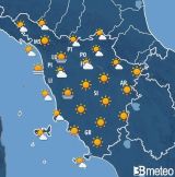
North Appennino - Weather situation in North Appennino
very cloudy skies with precipitation affecting the entire area from the morning, becoming particularly intense in the afternoon over the central mountains; easing of the phenomena from the evening.
today, Thursday 12 November 2026Weather forecasts for ski resorts in North Appennino:
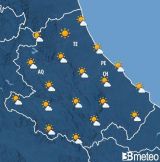
Central Appennino - Weather situation in Central Appennino
Strong Libeccio winds in central and southern Italy, with unsettled weather in the north-central regions and along the Apennine ridge. Increasing instability over the mid-to-upper Adriatic side from the afternoon-evening, with temperatures generally falling
SITUATION: After the passage of the Atlantic disturbance which, yesterday, brought stormy conditions to the northern regions The article Strong Libeccio winds in central and southern Italy, with unsettled weather in the north-central regions and along the Apennine ridge. Increasing instability over the mid-to-upper Adriatic side from the afternoon-evening, with temperatures generally falling comes from AbruzzoMeteo.
Weather forecasts for ski resorts in Central Appennino:
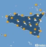
South Appennino - Sicily - Weather situation in Sicily
Weather Sicily: Thursday strong southerly winds, intense gusts in the Tyrrhenian areas and still local highs of +28°/30°C
Greetings from Weathersicily! The meteorological phase characterized by stable conditions and temperatures above the average for the period continues, especially in the Tyrrhenian area (but also between siracusano and catanese), where the southerly wind regime, together with the orographic component, causes a more pronounced rise in temperatures, with consequent maximum values of up to +27°/29°C in […] The article Weather Sicily: Thursday strong southerly winds, intense gusts in the Tyrrhenian areas and still local highs of +28°/30°C comes from Meteo Sicilia » Weather Sicily.it.