
Best Ski Slopes

Alessandro Fulci

NDR: Photos and stories prior to the opening of the new Mont Blanc cable car from Courmayeur.
Sunday 1 July 2007 11 minutes reading time
The Mont Blanc cable car, which connects La Palud, near Courmayeur, to Chamonix, is divided into 6 sections. The first goes from La Palud to the Pavillon du Mont Fréty (2173 m.), With the Saussurea alpine botanical garden (admission is included in the cable car price). The second leads up to the Rifugio Torino, at 3375 m. The last Italian stretch ends at 3462 m. of Punta Helbronner, on the border with France, where a permanent display of crystals is housed. The fourth stretch, the most spectacular, with its 5 km length, connects the Helbronner Point to the Aiguille du Midi, the highest point, at an altitude of 3842. From the Aiguille du Midi it is possible to descend to Plan de L ' 'Aiguille, at 2137 m., And from here to Chamonix. It is incredibly easy to find people who would be openly afraid to climb this plant, especially on the panoramic cable car from Punta Helbronner to the Aiguille du Midi. The cable car is actually no more dangerous than the others, although the long span on the Vallée Blanche in the case of wind fluctuates laterally and even vertically by several meters, stopping several times (when a group of cabins arrives at the stations) and sometimes even backing away. However, this is an experience not to be missed for mountain lovers. If you are interested, wear very heavy clothes even in the height of summer (it can go down to -10 ° C, even if when I took the photos, on August 7th 2000, the temperature was inviting), sunglasses, high sun cream protection (high does not mean 5-6!) and a perfect day. Find out about the weather conditions before you leave because the crossing is easily closed due to the wind, and if the wind continues there is the risk of having to return by bus. Over 3000 meters, and worse to the 3842 of the Aiguille du Midi, oxygen is little. Don't underestimate this if you know you have little breath. The flyer of the Aiguille du Midi says: Walk slowly, you are more than 3800 m. of altitude. A good test: you must be able to talk while you walk, without losing your breath. Those who have heart and / or pressure problems are strongly advised against climbing. The cable car was built in the 1960s, but it is still one of the most spectacular in the world, and has some unique technical solutions, such as the suspended pylon, and offers the possibility of admiring an incredible panorama, but at the price of an environmental impact not indifferent. The criticisms that are being made at the plant, which among other things remain in operation throughout the year, mainly concern the influx of too many people (unprepared as well as ecologically careless, but also experienced mountaineers) in the high mountains , with the risk of degradation of the latter; if it were a question of building it, I would certainly be against it, but since it did not seem to me to be lost, and what follows are some of the photos I took as a souvenir and documentation of the company. I appreciate, however, that after my first visit a decade ago, the ski lifts at the base of Punta Helbronner were dismantled, thus dedicating the area more to mountaineering than to skiing, notoriously more devastating.
The photos of the Alessandro Fulci crossing
La Palud Waiting for your turn to get on the first part of the cable car, you can see the cabins going up and down from the crowded square.
After departure from Pavillon On the cable car that reaches the Rifugio Torino in a single bay. Below us the Saussurea botanical garden, in the background Courmayeur.
Torino Refuge Shortly after departure from the Torino Vecchio Refuge station, heading towards the Helbronner point. To our right, take the Torino Nuovo Refuge building. To the right of the photo is the covered staircase leading to the Vecchio.
From the terrace of Punta Helbronner Looking down on the Italian side you see the two Turin shelters, the Old one at the bottom and the New one at the top, with the tremendous covered double-slope staircase that connects them.
Cervino and Monte Rosa from Punta Helbronner From the Helbronner tip you can see, in the distance, more than 30 km away, the unmistakable peak of the Matterhorn and the Monte Rosa massif
on the glacier at Punta Helbronner Also from Punta Helbronner it is possible to descend along this staircase in a fenced and controlled area, where to experiment ... the thrill of walking on the glacier safely, without the need to be roped or real climbers.
Gros Rognon Before getting back on the cable car, in the direction of France we admire the route, with the suspended pylon, the passage on the Gros Rognon (with change of the supporting cable and slight deviation) and at the bottom the outline of the Aiguille du Midi.
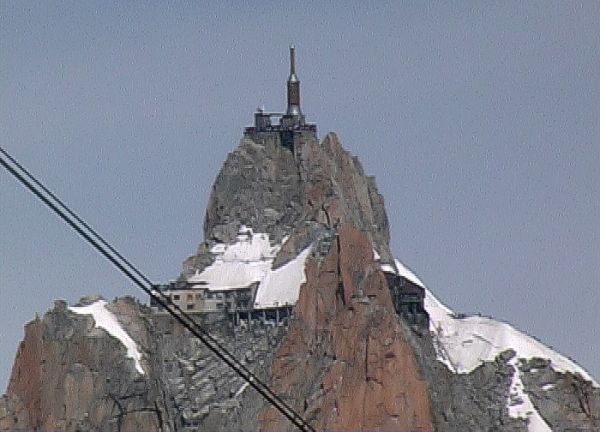
Aiguille du Midi from Punta Helbronner The Aiguille du Midi is seen at a distance of several kilometers from the Helbronner Point with a powerful zoom (photo from the video)
Monte Bianco Gondola We have just started from Punta Helbronner, and we are approaching the suspended pylon. You can see the shadow on the glacier below, not far from a small rope and some curtains. In the few days of good weather, many mountaineers face the crossing.
Rope towards Aiguille du Midi Just before the suspended pylon (you can clearly see the three sturdy cables that hold it in place) you can better see the strings that head towards the Aiguille du Midi and the group of tents.
Il Dente del Gigante After passing the suspended pylon, you go down several tens of meters: the span is unique up to Gros Rognon, which is still very far away.
Mer de Glace The long glacier that descends towards Chamonix starts here.
top of the white A close-up image (with a 200 mm.) of the top. Very small, several climbers climb to the right of Mont Maudit (4465 m.) Towards the White. Their path can be seen zigzagging up to the top.
Cordate to the Auguille du midi On fine summer days there is a continuous coming and going of cordate at the Aiguille du Midi. From this point the access to the station, almost entirely carved into the rock, is through an ice tunnel.
climb to the Aiguille du midi The final stretch of the climb, in a wider frame. The ice tunnel is under the ice mass to the right of the visible path.
© ALL RIGHTS RESERVED
Social media engagement
More details
Ultimi in Regioni
Chiesa Valmalenco
La Valmalenco offre uno dei comprensori sciistici più panoramici della Valtellina, sviluppato principalmente nella conca dell’Alpe Palù e circondato dalle grandi montagne del gruppo del Bernina. Boschi di conifere, ampi pendii in quota e il lago Palù compongono un ambiente alpino ancora relativamente integro, con vedute che spaziano verso il Pizzo Scalino, il Monte Disgrazia e le cime che separano la valle dall’Engadina.
2