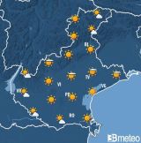
Between Thursday and the first part of Friday, an Atlantic trough associated with a deep surface low-pressure system will move across Veneto, bringing a spell of unsettled weather; during the first phase, very mild air will be advected aloft from the south-west, while at the end of the event decidedly colder air masses will move in. Over the weekend, an intervening ridge will ensure stable atmospheric conditions in an almost wintry thermal context. On Monday, a new trough will move across the region, bringing further precipitation and a lower snowfall limit. Subsequently, a predominantly westerly flow will become established, with some cyclonic undulations that may bring some further precipitation amid generally variable conditions.
336