
Snow and Weather Forecasts
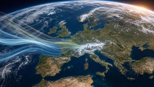

The latest update from the American Climate Prediction Center confirms the rapid strengthening of El Niño. The probability that it will reach very high intensity during the autumn and winter exceeds 90%, while the possibility of an unprecedented event in records dating back to 1950 has risen to 69%. But what could the effects be on the European winter and the Alps?
Thursday 27 August 11 minutes reading time
El Niño continues to strengthen in the equatorial Pacific and could reach exceptional intensity over the coming months. This is the conclusion of the latest update published on 24 August 2026 by the NOAA Climate Prediction Center, the US agency that monitors the evolution of the ENSO phenomenon.
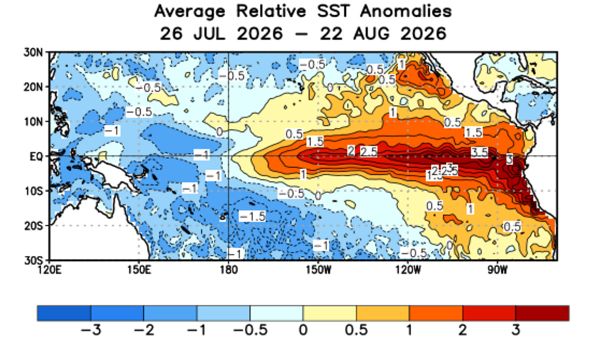
The new analyses confirm the presence of El Niño and show above-average sea-surface temperatures across much of the central-eastern and eastern equatorial Pacific. Atmospheric circulation is also now displaying characteristics fully consistent with the development of the phenomenon.
According to NOAA’s official forecast, there is a probability of more than 90% that El Niño will reach very strong intensity between autumn 2026 and winter 2026/2027. The phenomenon is also expected to persist at least until spring 2027.
A 69% probability of a historic El Niño
The most significant figure in the latest update concerns the possible intensity of the event. For the quarter from October to December 2026, NOAA assigns a 69% probability to the event exceeding the strength of all El Niño episodes recorded since 1950.
To fall into this category, the quarterly value of the Relative Oceanic Niño Index, abbreviated as RONI, would have to reach or exceed +2.5 °C.
The definition of a “historic” event therefore concerns the intensity of the temperature anomaly in the Pacific and does not automatically imply unprecedented weather effects in every part of the world. NOAA itself emphasizes that a very intense El Niño increases the probability of typical consequences of the phenomenon, without making them certain.
The eastern Pacific is getting warmer and warmer
Data observed in recent weeks show particularly pronounced warming in the eastern regions of the equatorial Pacific. The latest weekly sea-surface temperature anomalies have reached:
- 0.0 °C in the Niño 4 region;
- +1.8 °C in the Niño 3.4 region;
- +2.5 °C in the Niño 3 region;
- +3.2 °C in the Niño 1+2 region, located closer to the coast of South America.
Extensive positive temperature anomalies are also present below the ocean surface in the central-eastern and eastern Pacific. The heat content of the upper 300 metres of the ocean remains above average, indicating the presence of a substantial reservoir of warm water capable of further sustaining the phenomenon.
The oceanic component is now accompanied by a well-defined atmospheric response. Precipitation and convective activity have increased over the central and eastern Pacific, while they have decreased over Indonesia. Wind anomalies at low and high altitudes confirm that the ocean and atmosphere are interacting according to the characteristic El Niño pattern.
A very rapid transition from La Niña to El Niño
The evolution observed during 2026 has been particularly rapid. Until February, temperatures were below average across much of the equatorial Pacific as a result of the previous La Niña phase.
The first positive anomalies appeared at the beginning of February in the far eastern sector of the basin. From mid-April, the warming progressively spread towards the central-eastern Pacific, accelerating further during the summer.
The average RONI value rose from -0.9 °C in the December 2025-February 2026 quarter to +1.0 °C in the May-July 2026 period. This is a very marked change, which models suggest will continue at least until the end of the year.
What consequences for the European winter?
The most recognizable and statistically reliable effects of El Niño primarily affect the tropical Pacific, the Americas, Asia and Oceania. The connection with the European climate is more indirect and shows much greater variability from one event to another.
In Europe, the course of winter also depends on numerous other factors, including the North Atlantic Oscillation, the position of the polar vortex, stratospheric conditions, Atlantic temperatures and the distribution of high- and low-pressure systems across the continent.
Some studies and analyses of past events suggest that an intense El Niño may favour a weakening of the stratospheric polar vortex during the second half of winter. This could increase the possibility of cold-air outbreaks towards the mid-latitudes, but it does not make it possible to determine months in advance where these air masses will head.
It is therefore incorrect to conclude (as we have read on other websites) that a very strong El Niño will necessarily bring a colder or snowier winter to the Alps. The phenomenon is nevertheless an important element of the global climate system and may influence atmospheric circulation even at our latitudes.
Monitoring winter 2026/2027. Several more updates will be needed
The projections published in August describe an increasingly robust scenario regarding the continuation and strengthening of El Niño. It remains premature, however, to translate this forecast into precise indications for the Italian winter and snowfall patterns at ski resorts.
The coming months will make it possible to assess the actual intensity reached by the phenomenon and, above all, its interaction with the other main atmospheric indices in the Northern Hemisphere.
NOAA’s next monthly update on the evolution of El Niño is scheduled for 10 September 2026.
© ALL RIGHTS RESERVED
Social media engagement
LISTA DI LETTURA


2