
Snow and Weather Forecasts
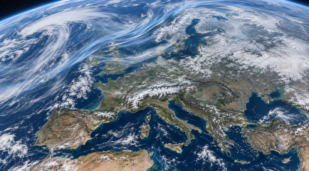

The NOAA's latest update confirms a further strengthening of El Niño. For the October-December period, the probability that the phenomenon will reach an intensity never observed in the historical record dating back to 1950 has risen from 69 to 75%. This is a scenario that we need to monitor in order to understand the possible scenarios for winter 2026/2027.
Friday 11 September, 16:42 10 minutes reading time
As anticipated in our previous analyses, the NOAA Climate Prediction Center published its latest update on the evolution of El Niño on September 10. The data confirm that the phenomenon continues to strengthen rapidly in the equatorial Pacific and could reach exceptional intensity between autumn and the beginning of winter 2026/2027.
The probability that El Niño will become very strong during the autumn and winter of the Northern Hemisphere remains above 90%. The possibility that, during the October-December 2026 period, the phenomenon will reach an intensity exceeding that of all events recorded in the historical series beginning in 1950 has instead risen to 75%.
The probability of a historic El Niño rises to 75%
To be considered “historic” according to the criterion used by NOAA, the quarterly value of the Relative Oceanic Niño Index, indicated by the acronym RONI, would have to reach or exceed +2.5 °C.
Compared with the update published in August, the probability of reaching this threshold has therefore increased by six percentage points, from 69 to 75%. The official forecast, produced by combining several North American and international climate models, indicates that El Niño should continue to intensify at least until the end of 2026.
NOAA points out, however, that the definition of a historic event refers exclusively to the strength of the thermal anomaly in the tropical Pacific. It does not mean that every area of the planet must necessarily face unprecedented weather conditions.
The eastern Pacific continues to warm
Over the past month, sea-surface temperatures have risen further in the central-eastern equatorial Pacific. The anomalies recorded in the main regions used to monitor El Niño have reached:
- +0.1 °C in the Niño 4 region;
- +1.8 °C in the Niño 3.4 region;
- +2.5 °C in the Niño 3 region;
- +3.4 °C in the Niño 1+2 region, closer to the coasts of South America.
Local anomalies exceeding +3 °C have been observed in the eastern equatorial Pacific. A large reservoir of warmer-than-average water also remains beneath the ocean surface, with particularly high anomalies in some deep areas.
The atmospheric response is now fully consistent with the presence of El Niño: precipitation and thunderstorm activity are more intense over the central and eastern Pacific, while they are reduced over Indonesia. Wind anomalies also confirm the growing interaction between the ocean and the atmosphere.
What does this change for forecasts for winter 2026/2027 in the Alps?
The new update makes the presence of an exceptionally intense El Niño during the first part of winter 2026/2027 even more likely. This is an important factor for seasonal forecasts, but it does not yet make it possible to determine how temperatures and precipitation will develop in the Alps.
The effects of El Niño are statistically more evident in regions bordering the Pacific and in certain areas of the Americas. The connection with the European climate is weaker and can vary considerably from one event to another.
NOAA itself emphasizes that a very intense event makes the effects normally associated with El Niño more likely, but does not guarantee that they will occur in every region.
In Europe and across the Alpine arc, the course of the winter will also depend on the North Atlantic Oscillation, the conditions of the polar vortex and the stratosphere, Atlantic temperatures, and the position of the main high- and low-pressure systems.
Consequently, it would not be correct to translate the new 75% indicated by NOAA into a forecast of a winter that will definitely be cold, mild, snowy, or dry in the Alps. The intensity of El Niño and the amount of snow that will fall on our mountains are not directly proportional quantities.
There is no Alpine forecast yet.
Compared with the August update, the picture in the Pacific has become even clearer: El Niño is strengthening and now has a high probability of reaching exceptional values by the end of the year.
For the Alps, however, we will need the next outputs from seasonal models focused on Europe and, as winter approaches, indications from the other major atmospheric indices. Only by combining these elements will it be possible to identify any more credible signals regarding the season's overall development.
The message for skiers and mountain enthusiasts therefore remains cautious: El Niño will be one of the climatic protagonists of winter 2026/2027, but it still cannot tell us how much snow will fall in the Alps, or when and on which slopes.
NOAA's next monthly update is scheduled for October 8, 2026; at Neveitalia, we will continue to monitor developments.
© ALL RIGHTS RESERVED
Social media engagement
Più letti in Meteo e neve

NOAA: torna El Niño, come potrebbe influenzare l'inverno 2026-2027 sulle Alpi?
La NOAA (National Oceanic and Atmospheric Administration) ha pubblicato il 9 luglio il nuovo aggiornamento sul fenomeno climatico ENSO (El Niño-Southern Oscillation), confermando che El Niño è ormai in pieno sviluppo e che continuerà a rafforzarsi nei prossimi mesi. Secondo i climatologi statunitensi, il fenomeno dovrebbe raggiungere il proprio massimo proprio durante l'inverno boreale 2026-2027, con una probabilità del 97% di persistere fino alla primavera 2027 e con possibilità sempre più elevate di raggiungere un'intensità tra le più elevate osservate dal 1950.
260k