
Snow and Weather Forecasts
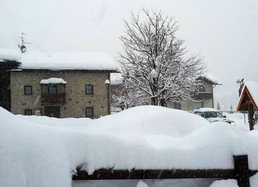

From Friday & Igrave; January 16 a trough North Atlantic proietter & agrave; finally perturbations North Atlantic towards the 'Italy, favoring a distinct change weather. The 'Alps sar & agrave; hit by a series of heavy snowfall over the weekend, up to 1 meter of fresh snow average odds, thanks to the typical stau from the south. Contrary to what happened behind the New Year, this time will not be affected southern regions.
Wednesday 14 January 2015 3 minutes reading time
The first flakes come down & agrave; January 14, especially in the Valle d''Aosta AFTER THAT & eacute; the perturbation is sposter & agrave; eastward and will concern & agrave; the remaining areas of the Alps and the Alpine foothills, with the snow, the real one that arriver & agrave; Friday & Igrave; 16/01. The share of snow sar & agrave; around 1,000 meters on the Alpine mountains and just above the 1,500 meters on those pre-Alpine. In the valleys of Lombardy and Trentino western white lady potr & agrave; reach 700 meters. & nbsp; Particularly intense will be just the snowfall in Lombardy and Trentino Alto Adige, but will not make exceptions to the findings of the Dolomites in the Veneto. & Nbsp; Even Piedmont and Friuli will benefit dell''arrivo of fresh, but only as of the day Saturday, 01/17
To the delight of skiers and especially for lovers of fresh Sunday 17 should be the main day. Sull''arco Alpine Central Eastern Europe, even, the flakes will fall even around 500 meters during the evening hours, while below the 1,000 meters of the Alpine foothills. Residues well in the day Sunday, 1/18, when a disturbance tender & agrave; to go down to the south, bringing snowfall central Apennines up in Abruzzo. The following week, then, especially between Tuesday & Igrave; 20/01 and Wednesday & Igrave; 21/01 the white blanket could also arrive in large cities & agrave; North. Turin and Milanesi are warned.
© ALL RIGHTS RESERVED
Social media engagement
More about Snow and Weather Forecasts

Weather and Snow Forecasts
El Niño strengthens: probability of a historic event in winter 2026/2027 rises to 75%
meteo@neveitalia, Friday 11 September, 16:42
Weather and Snow Forecasts
El Niño strengthens further: NOAA forecasts a possible historic event in winter 2026/2027
meteo@neveitalia, Thursday 27 August
Weather and Snow Forecasts
Nuova Zelanda, irruzione di freddo artico: l'Isola del Sud si imbianca
meteo@neveitalia, Tuesday 4 August 2026
Weather and Snow Forecasts
NOAA: El Niño returns—how could it affect the 2026–2027 winter in the Alps?
meteo@neveitalia, Friday 10 July 2026
Weather and Snow Forecasts
Una grande nevicata di fine stagione sulle Alpi: anche oltre mezzo metro di neve fresca nel weekend
meteo@neveitalia, Friday 13 March 2026
Weather and Snow Forecasts
Inverno protagonista sulle Alpi: nevicate diffuse da Ovest a Est, accumuli importanti nel Cuneese
meteo@neveitalia, Tuesday 16 December 2025Più letti in Meteo e neve

NOAA: torna El Niño, come potrebbe influenzare l'inverno 2026-2027 sulle Alpi?
La NOAA (National Oceanic and Atmospheric Administration) ha pubblicato il 9 luglio il nuovo aggiornamento sul fenomeno climatico ENSO (El Niño-Southern Oscillation), confermando che El Niño è ormai in pieno sviluppo e che continuerà a rafforzarsi nei prossimi mesi. Secondo i climatologi statunitensi, il fenomeno dovrebbe raggiungere il proprio massimo proprio durante l'inverno boreale 2026-2027, con una probabilità del 97% di persistere fino alla primavera 2027 e con possibilità sempre più elevate di raggiungere un'intensità tra le più elevate osservate dal 1950.
2