
Snow and Weather ForecastsSnow Weather

Gettyimages 84156313

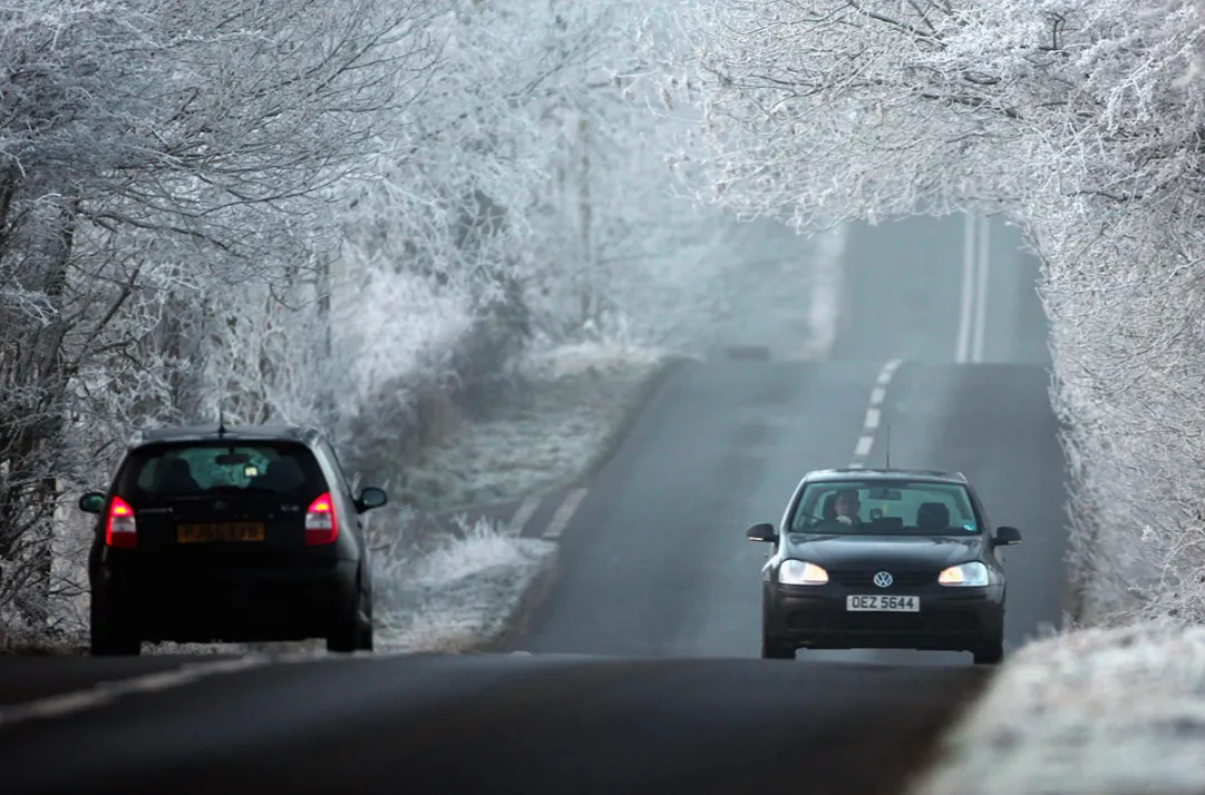
During the weekend the temperatures will suffer a considerable decrease, the clearings in the North will favor the first night frosts and on the Apennine ridge, thanks to a perturbation arriving on Saturday the first snowflakes could arrive on the Apennine ridge.
Wednesday 18 November 2020 2 minutes reading time
With the temporary weakening of the anticyclone on the central Mediterranean, a disturbance has already brought some autumn back to Italy. However, the 3BMeteo experts foresee an important cold eruption from northern Europe from Friday that will cause a drastic decrease in temperatures over a large part of Italy. On stretches of the Po Valley, as well as on the Alpine valley floors, temperatures will be able to reach around zero degrees, causing the first frosts of the season over the weekend thanks to the clearing at night.
According to forecasts, the North Sea front pushed by cold air will push into the central Mediterranean as early as Friday night. After having unloaded some jibs in the early hours of the night on the border Alps, the North will jump, which will remain downwind of the Alps with more sunny weather, with the exception of some showers in Emilia Romagna. It will recur in the central regions and in Sardinia with showers and thunderstorms that will spread towards the lower Tyrrhenian, Basilicata and upper Puglia by the end of the day, with phenomena also of strong intensity on Campania and Calabria. The cold air following it will also cause a drop in temperatures and snow levels, with some snowflakes falling on the Apennines up to 900 / 1200m on the northern one and up to 1200 / 1600m on the central one.
© ALL RIGHTS RESERVED
Social media engagement
More about Snow and Weather Forecasts
Weather and Snow Forecasts
El Niño strengthens: probability of a historic event in winter 2026/2027 rises to 75%
meteo@neveitalia, Friday 11 September, 16:42
Weather and Snow Forecasts
El Niño strengthens further: NOAA forecasts a possible historic event in winter 2026/2027
meteo@neveitalia, Thursday 27 August
Weather and Snow Forecasts
Nuova Zelanda, irruzione di freddo artico: l'Isola del Sud si imbianca
meteo@neveitalia, Tuesday 4 August 2026
Weather and Snow Forecasts
NOAA: El Niño returns—how could it affect the 2026–2027 winter in the Alps?
meteo@neveitalia, Friday 10 July 2026
Weather and Snow Forecasts
Una grande nevicata di fine stagione sulle Alpi: anche oltre mezzo metro di neve fresca nel weekend
meteo@neveitalia, Friday 13 March 2026
Weather and Snow Forecasts
Inverno protagonista sulle Alpi: nevicate diffuse da Ovest a Est, accumuli importanti nel Cuneese
meteo@neveitalia, Tuesday 16 December 2025Più letti in Meteo e neve

NOAA: torna El Niño, come potrebbe influenzare l'inverno 2026-2027 sulle Alpi?
La NOAA (National Oceanic and Atmospheric Administration) ha pubblicato il 9 luglio il nuovo aggiornamento sul fenomeno climatico ENSO (El Niño-Southern Oscillation), confermando che El Niño è ormai in pieno sviluppo e che continuerà a rafforzarsi nei prossimi mesi. Secondo i climatologi statunitensi, il fenomeno dovrebbe raggiungere il proprio massimo proprio durante l'inverno boreale 2026-2027, con una probabilità del 97% di persistere fino alla primavera 2027 e con possibilità sempre più elevate di raggiungere un'intensità tra le più elevate osservate dal 1950.
83